Laos – the south – caves and 4000 islands…
March 5, 2013 in Laos, On the road
 Since we liked the north of Laos very much, we also wanted to explore the south of the country. In the north we had especially liked the mountain landscape – in the south it was more the huge caves in the limestone hills, and the many islands in the wide Mekong River that we found very memorable.
First, we spent three days in Vientiane, the capital of Laos, where we organized our visas for Thailand. Then we went further south on the boring main road 13 – always along the Mekong river and the border to Thailand.
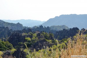
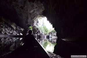
At the little village Vieng Kham we turned east on road no. 8, which soon led us through a spectacular karst landscape with steep and cragged limestone rocks. From here we made an excursion to the Kong Lor cave, which is a must-see! The cave is 7 kilometres long, and a river runs through it. It is sometimes up to 100 metres high, and about the same wide. You can hire a boat that takes you all the way through the cave to the other side and back, which takes at least 2.5 hours. You should bring a torch because there is no light in the cave (only some dripstone formations at the beginning are illuminated). Also waterproof sandals will be helpful, because you have to leave the boat a few times – especially during the dry season, when the water is very shallow.
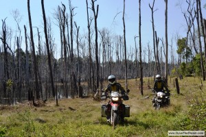
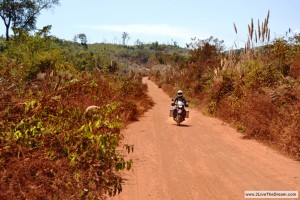
In Lak Xao we then turned south on the 8S. This road is not paved and very dusty. For quite a few kilometres it is also very bumpy, because of rocks in the soil. No problem for our GSes – but we felt sorry for the tourists that we saw riding little scooters over this road. The route is recommended as the “Loop” in the Lonely Planet. Therefore, you meet lots of backpackers here on rented scooters.
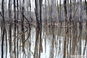
After we had passed the bumpy and dusty part of the road, we came to the stunning Nam Theun Dam. It is a huge lake, which has been flooded only a few years ago. Whilst we were driving on the gravel road over lots of islands across the lake (the tops of the sunken hills), which are connected by bridges, we were gaping at the stunning landscape: the lake is still full of the skeletons of the trees that were growing here before the flooding. All along the banks of the lake dead trees point their branches in the air.
The cities Thakhek and Savannakhet are nothing special, and in our opinion not worth a visit. But if you are in this area, the village Tad Lo is very nice with lots of waterfalls around it. It is not far from the main road no. 20 between Pakxe and Salavan. From Tad Lo we went to Sekhong, and then further south until we left the road at Phoukham and went up to the Bolaven Plateau. The area here is not flat anymore, and there are lots of hills and coffee plantations.
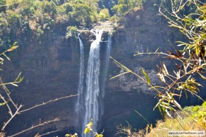
The very dusty and bumpy road over the Bolaven Plateau to Pakxon leads through lots of natural forest landscape. There are only few very small villages along the road, which is currently under construction. We saw almost no traffic. The area is also full of huge waterfalls, such as the Katamtok. Some can be seen from the road.
The road from Pakxon to Pakse was no fun. It was just one big construction side, full of trucks and dust, and the traffic was continuously increasing. But the climate up on the plateau is nice. It is cooler than in the lowlands, and pine trees grow along the road. Beyond them huge coffee plantations cover the hills.
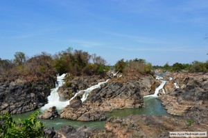
The last highlight of our visit to Laos was a trip to the “4000 Islands” in the south at the border to Cambodia. The Mekong reaches its maximum width here (14 kilometres during the rain season!), and is full of islands – but if there are really 4000…? Between the southern islands the mighty river suddenly becomes wild and goes over waterfalls and rapids… a fantastic sight that is very impressive!
We chose as a base the island Khong, which is easily accessible by ferry. And from there we went by passenger boat through the other islands and down to Don Det, where we rented bicycles.
Above all, we liked the north better than the south – but it is nevertheless a great area worth a visit. Highlights were the 4000 Islands and the Kong Lor cave.
A warning to other motorcycle travellers: On many maps the road 18 between Attapeu and the main road no. 13 is marked as a big main road. We have heard from others that it is everything else but a main road. It is a really bad jungle road in a terrible condition and with some very deep and very long river crossings We didn’t go along there, but we were thinking about it – luckily we chose another route. It is probably better to go there only with light-weight dirt bikes.
More pictures in our photo gallery Laos
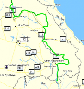
Here is our route through the south of Laos. If you want the GPS data, just send us a message.
Travel information
Visa – You get 30 days upon arrival (also at the land border; 30 US$). We heard that it can be extended in the country.
Fuel – It is available almost everywhere; but mostly they have only 91 Octane.
Currency – Lao Kip. 10000 Kip are about 1 EUR
ATM machines – They can easily be found in all cities and tourist hot-spots; you have to pay about 20000 to 40000 Kip per transaction.
Roads – Everything exists in Laos: from wild jungle tracks to four-lane roads in excellent condition. Almost all of the main roads are asphalted and in good condition. But if you are looking for some more adventurous roads, they are easy to find…
Costs – Food starts at about 20000 Kip (2 EUR), beer costs about 10000 (1 EUR) Kip per bottle, guest houses start (depending where you are) at 50000 -100000 Kip (5-10 EUR) per room
Traffic – Almost none. It’s a right hand driving country.
Carnet de Passage? – We used it, but it is not required.
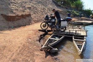
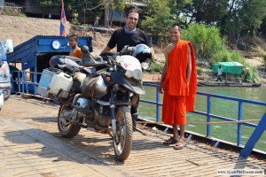
Ferries – The ferries over the rivers are relatively expensive. We paid between 20000 and 50000 Kip per Motorcycle – negotiations were almost never successful.
